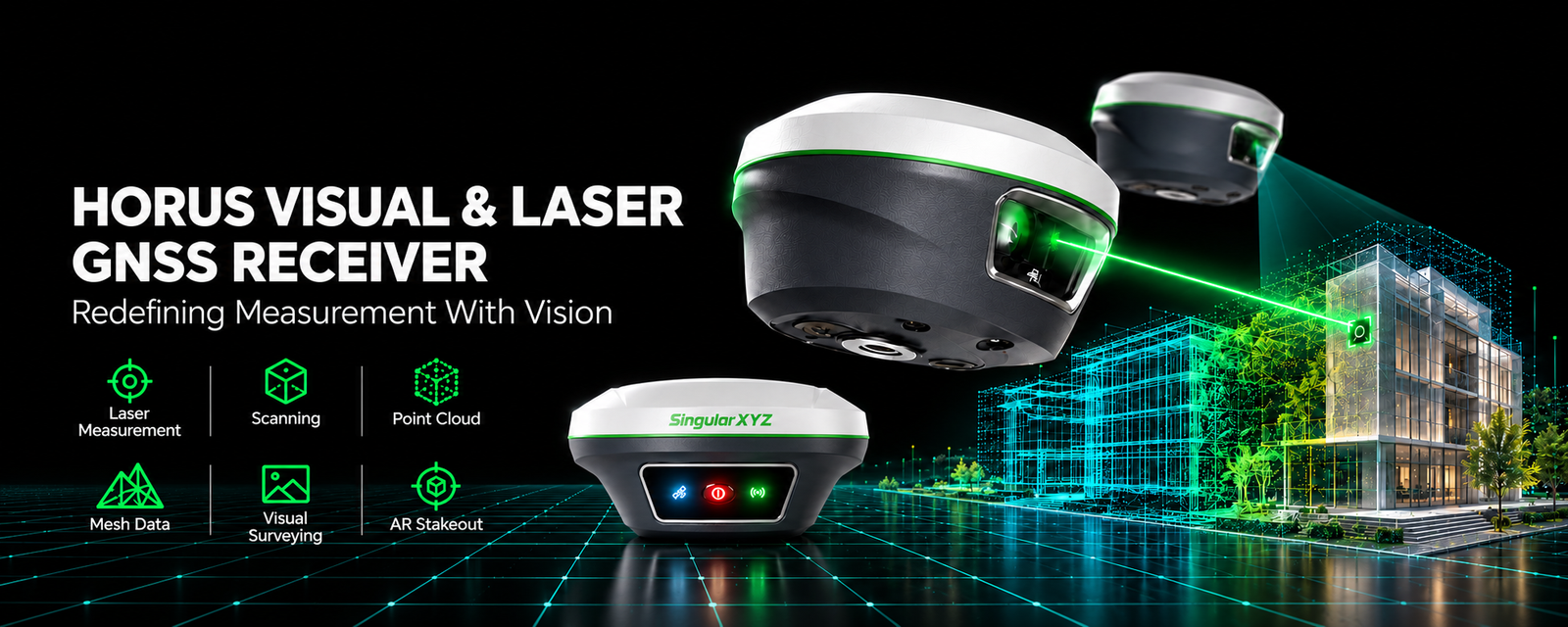
SingularXYZ Horus Visual & Laser GNSS Receiver — HD starlight camera, dual-camera AR stakeout, non-contact laser, 60° tilt IMU
GNSS Receiver · Visual & Laser · SingularXYZ

Horus Visual & LaserMeasurement redefined with vision

A visual and laser RTK GNSS receiver that brings camera-based measurement to the field. A 1408-channel full-constellation engine pairs with an HD starlight camera, dual 2 MP global-shutter cameras and a Class 3R laser for HD visual surveying, camera-assisted non-contact laser measurement up to 120 m*, and dual-camera auto-switching AR stakeout. A 60° IMU, quad-core 1.5 GHz CPU with a 2.0 Tops NPU, 8 GB storage and a 6600 mAh battery keep it running up to 12 hours inside a 720 g IP67 aluminium-magnesium body.

Request a Quote
Channels
1408
Cameras
Dual 2 MP
Laser
120 m*
Tilt
60°
Battery
12 hrs
Rating
IP67
Features

Vision-led surveying, in one receiver

01

Precise visual surveying

An HD starlight camera paired with advanced visual algorithms lets you survey by capture, tap and measure — obtaining centimetre-level photogrammetry results quickly and intuitively, without complex post-processing on site.

02

Camera-assisted laser surveying

The back camera provides clear visual-assisted targeting for precise aiming of the non-contact laser, extending the surveying range up to 120 m*. The laser is Class 3R — direct eye exposure must be avoided.

03

Dual-camera AR stakeout

Dual cameras with auto distance-based switching use the back camera for long-range points and the bottom camera for close-range guidance, giving the most intuitive and accurate view for every stakeout.

04

An efficient visual workflow

Capture multiple points from a single photo while preserving all image records for verification or missed-point recovery. Every detail stays available, so you get more done from each setup.

05

Visual data ready for 3D modelling*

Horus generates high-quality visual data ready for seamless integration with third-party post-processing software, simplifying 3D modelling and mapping. Modelling itself happens in the third-party software, not on the receiver.

06

A new-generation IMU

Supporting up to 60° tilt compensation, the IMU module ensures stable and precise performance — a robust foundation for visual, laser and pole surveying alike.

07

Full-constellation tracking

Horus tracks GPS, BDS, GLONASS, Galileo, QZSS and SBAS simultaneously. Advanced anti-interference algorithms ensure a fast, reliable FIX even in urban canyons, dense forests or signal-challenged areas.

08

Smart engineering in every part

A 6600 mAh battery supports 12 hours of continuous work, an IP67 aluminium-magnesium housing withstands 2 m drops, and a quad-core 1.5 GHz platform with a 2.0 Tops NPU powers the on-board visual processing.

How the Horus differs

The Horus is the visual-and-laser member of the SingularXYZ GNSS family: an HD starlight camera, dual global-shutter cameras and a Class 3R laser enable visual surveying, camera-assisted laser measurement and AR stakeout. Visual data is exported for third-party 3D modelling — modelling is not performed on the receiver. It carries no internal 4G modem; long-range corrections are delivered through internal UHF or PDA CORS mode over Bluetooth.

Correction & Working Modes

Corrections, your way

The Horus supports standard RTCM correction data through its internal UHF radio or PDA CORS network mode over Bluetooth. Static observations can also be recorded to 8 GB of onboard storage for post-processing. Ranges are qualified by the manufacturer and depend on field conditions.

Up to 15 km

Internal Radio Mode

Built-in UHF, optimal conditions

Network coverage

PDA CORS Mode

Via Bluetooth to local CORS stations

Field Ready

Compact, connected, rugged

Power
6600 mAh internal battery with up to 12 hours of continuous working time, with about 3.5 hours of fast charging over Type-C.
Durability
IP67 aluminium-magnesium housing rated for 2 m drops, built to withstand harsh field environments.
Connectivity
Internal UHF radio, NFC and Bluetooth for quick pairing, Wi-Fi with WebUI, and a Type-C USB interface for data and charging. 8 GB of onboard storage keeps field data close at hand.
SingularPad
Works with SingularPad, SingularXYZ’s Android-based professional field software, enhanced with Wi-Fi data interaction, visual surveying, AR stakeout and laser survey capabilities.
Industries & Applications

Where the Horus earns its keep

From cadastral boundaries to photogrammetry data capture, the Horus delivers reliable centimetre-level accuracy and visual measurement wherever your project takes you.

  • Cadastral and land surveying
  • Construction layout and staking
  • Engineering and infrastructure surveying
  • Topographic and mapping work
  • 3D modelling and photogrammetry data capture
  • Hazardous or hard-to-reach area surveying
Specifications

Full technical detail

Satellites Tracking

Channels
1408
BDS
B1I, B2I, B3I, B1C, B2a, B2b
GPS
L1C/A, L1C, L2C, L2P(Y), L5
GLONASS
G1, G2, G3
Galileo
E1, E5a, E5b, E6
QZSS
L1C/A, L1C, L2C, L5
SBAS
WAAS, EGNOS, MSAS, GAGAN, SDCM

Hardware

Platform
Quad-core 1.5 GHz CPU, 2.0 Tops NPU
Laser Sensor
Class 3R, avoid direct eye exposure; Range: 120 m*
Camera
Dual-camera with 2 MP global shutter; Frame: 25 fps
Communication
UHF / Bluetooth / NFC / Wi-Fi / Type-C USB
Storage
8 GB
Front Panel
3 LED indicators & 1 power button

Accuracy

RTK
8 mm + 1 ppm horizontally / 15 mm + 1 ppm vertically
Static Post-processing
2.5 mm + 0.5 ppm horizontally / 5 mm + 0.5 ppm vertically
Tilt Surveying
< ±2.5 cm, within 60° tilt range
Visual Surveying
2–5 cm @ 2–20 m range, typical
AR Stakeout
8 mm + 1 ppm horizontally / 15 mm + 1 ppm vertically
Laser Tilt Surveying
3 cm @ 10 m range, typical

General

WebUI
Accessible via Wi-Fi
Battery
6600 mAh, up to 12 hours working time; fast charge ~3.5 hours
Size
Φ133 mm × 72 mm
Weight
720 g
Waterproof & Dustproof
IP67
Casing
Aluminium-magnesium, 2 m drop stated

* Laser range up to 120 m under optimal conditions. Laser tilt surveying accuracy of 3 cm is stated at a 10 m range, typical — not at 120 m. Visual surveying accuracy of 2–5 cm is typical at a 2–20 m range. The laser is Class 3R; avoid direct eye exposure. Visual data is exported for third-party 3D modelling; modelling is not performed on the receiver.

Put the Horus to work on your next project

Authorized & Exclusive SingularXYZ partner for the UAE and Pakistan. Request a quote or message us on WhatsApp for pricing and availability.

Request a Quote

Horus Visual & Laser product information

Download the Horus product information as a PDF.

Download PDF
    RAO GEO TECH.FZE Logo

    RAO GEO TECH.FZE

    Authorized SingularXYZ Partner

    Leading supplier of professional surveying equipment in the UAE and Pakistan. Expert support and training services.

    Our Locations
    SRTIP Block B, Office -B27-046 , Sharjah, UAE
    Abu Dhabi Mussafah, United Arab Emirates

    © 2026 RAO GEO TECH.FZE. All rights reserved.

    Join With Us