SingularXYZ H2 Handheld 3D Laser Scanner
Laser Scanner · Handheld · SingularXYZ

H2Handheld 3D laser scanner

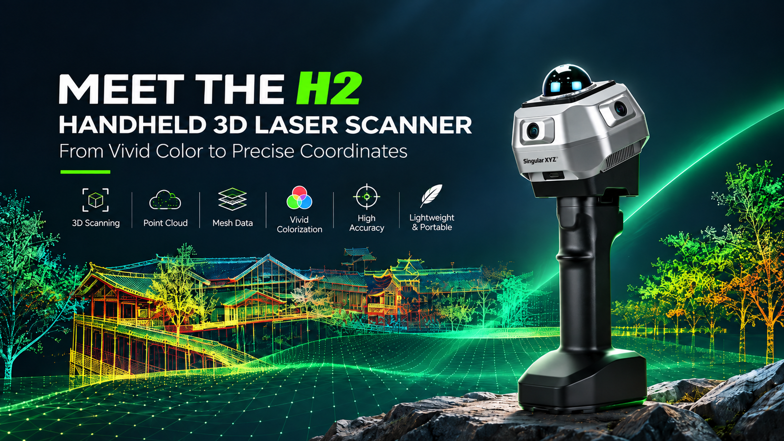
A handheld 3D laser scanner built around a 40-line LiDAR array that captures up to 200,000 points per second with a Class 1 eye-safe laser, delivering 1 cm accuracy at 10 m and a scan radius of 40–70 m (measured at greater than 10% or greater than 80% reflectivity). A full 360° horizontal and 59° vertical (-7° to 52°) field of view captures complete environmental details with minimized blind spots. A triple global-shutter fisheye camera system — three 2 MP cameras, each with a 127° horizontal, 101° vertical and 170° diagonal field of view — captures high-quality image data, and advanced colorization algorithms fuse it with the point cloud for realistic, colour-rich results. The modular design supports a smartphone bracket and an optional 1408-channel GNSS RTK module for real-world coordinate alignment. A built-in 256 GB SSD, Type-C USB 3.0 and Wi-Fi provide efficient data transfer, while an attachable smartphone bracket streams a real-time point cloud to iOS and Android devices. A 4000 mAh battery handle supports up to 2 hours of continuous operation. SingularCloud handles post-processing and the SingularCloud Go mobile app enables real-time viewing. The IP54 metal body weighs 740 g without handle.

Request a Quote
Points/sec
200,000
Accuracy
1 cm @ 10 m
Scan Radius
40–70 m
Cameras
3× 2 MP
Storage
256 GB SSD
Rating
IP54 · 740 g
Features

Vivid colour, dense capture, modular flexibility

01

Triple-camera colourization

Three global-shutter fisheye cameras capture high-quality image data with rich textures and natural colours. Advanced colorization algorithms fuse image data with the point cloud, delivering realistic colourized point clouds with fine detail.

02

Modular design for flexible deployment

A modular architecture supports flexible configurations with external accessories such as a smartphone bracket and an optional RTK module, enabling easier upgrades and adaptation to different application requirements.

03

Precise and dense LiDAR system

A 40-line LiDAR array supports up to 200,000 points/sec scanning speed with 1 cm accuracy at 10 m, capturing precise spatial details for reliable 3D reconstruction across various environments.

04

Ultra-wide 360° × 59° field of view

A full 360° horizontal range and 59° vertical coverage (-7° to 52°) captures complete environmental details with minimized blind spots, suited to interiors, facades, industrial facilities and other complex spaces.

05

Flexible transmission and external integration

Type-C ports, Wi-Fi transfer, external device connections and a built-in 256 GB SSD provide efficient data transfer and flexible integration with various accessories.

06

Real-world accuracy alignment

Beyond relative accuracy, an optional RTK module or a control point optimization workflow accurately registers point clouds into project coordinate systems for reliable georeferenced results.

07

Smartphone bracket with real-time viewing

An attachable smartphone bracket enables convenient one-handed operation and real-time scanning visualization, streaming the point cloud and device status to iOS and Android devices over Wi-Fi.

08

Long-lasting 4000 mAh battery

A 4000 mAh battery handle supports up to 2 hours of continuous operation, with an integrated power button, battery level display and Type-C charging port for convenient power management.

09

Field-ready in a compact build

An IP54-rated metal body delivers reliable durability for demanding field environments, and the 740 g compact, lightweight design (without handle) ensures comfortable operation and portability.

Software & Platform

Post-processing and field viewing

SingularCloud Post-Processing
SingularCloud optimizes point cloud quality through denoising, filtering and RTK/GCP registration. It supports colourized point cloud, mesh and CAD outputs, with built-in tools for measurement and volume calculation.
SingularCloud Go Field Viewer
The SingularCloud Go mobile app enables real-time point cloud viewing on Android and iOS devices, with RGB, Intensity and Elevation modes to verify scan quality and completeness directly in the field.
Industries & Applications

Where the H2 is specified

Suitable for construction mapping, infrastructure capture and heritage digitization.

  • Construction mapping
  • Infrastructure capture
  • Heritage digitization
Specifications

Full technical detail

Laser System

Laser Product Classification
Class 1 Eye Safe
Accuracy
1 cm @ 10 m
Scan Radius
40–70 m (measured at >10% or >80% reflectivity)
Max. Effective Measurement Rate
200,000 points/sec
FOV (Horizontal)
360°
FOV (Vertical)
59° (-7° to 52°)
Scanning Channel
40 lines

Imaging System

Number of Cameras
3 fisheye cameras
Camera Type
Global shutter
Resolution
2 MP per camera
FOV (Per Camera)
Horizontal 127°; Vertical 101°; Diagonal 170°

Connectivity & Expansion

Interface
Type-C USB 3.0
Storage
Built-in SSD, 256 GB
Network
Wi-Fi
GNSS RTK
Optional 1408-channel GNSS engine
Data Output Format (Post-Processing)
PCD, LAS, E57, LAZ, PLY, OBJ, DXF (indoor floor plan)

Physical & Electrical

Size
115 × 113 × 120 mm (without handle)
Weight
740 g without handle
Battery Handle
4000 mAh, up to 2 hours continuous operation; weight 485 g
Body
IP54-rated metal housing

Scan radius is stated at greater than 10% or greater than 80% reflectivity, as published by the manufacturer. The GNSS RTK module is optional and not included as standard.

Put the H2 on your next capture job

Authorized & Exclusive SingularXYZ partner for the UAE and Pakistan. Request a quote or message us on WhatsApp for pricing and availability.

Request a Quote
    RAO GEO TECH.FZE Logo

    RAO GEO TECH.FZE

    Authorized SingularXYZ Partner

    Leading supplier of professional surveying equipment in the UAE and Pakistan. Expert support and training services.

    Our Locations
    SRTIP Block B, Office -B27-046 , Sharjah, UAE
    Abu Dhabi Mussafah, United Arab Emirates

    © 2026 RAO GEO TECH.FZE. All rights reserved.

    Join With Us